

OpenTopoMap Viewer
Online client for maps from OTM project, import GPX and show own location
- Developer
- Serge Helfrich
- License
- Apache-2.0
- Package
org.nitri.opentopo- Category
- Navigation
- Latest version
- 1.42 · Nov 11, 2026
- Minimum Android
- Android 7.0
Screenshots
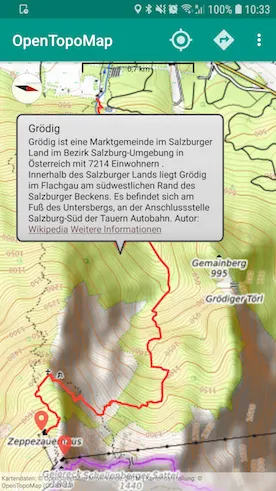
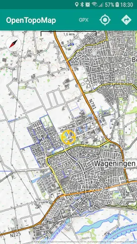
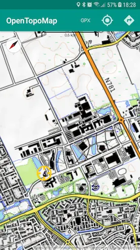
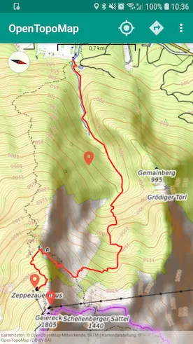
Description
OpenTopoMap Viewer is an open-source Android app for exploring topographic maps, viewing tracks and planning routes. Use it for hiking, cycling and discovering places, with detailed terrain maps and your own waypoints.
MAPS AND LOCATION
• Choose from OpenTopoMap, OpenTopoMap-R, Top-O-Map, OpenStreetMap, OpenHikingMap and Freemap.sk.
• Add Waymarked Trails overlays for hiking and cycling routes.
• Follow your location, return to it quickly and rotate the map using the compass or GPS bearing.
• View coordinates and elevation information.
TRACKS AND WAYPOINTS
• Open GPX files to display tracks, routes and waypoints.
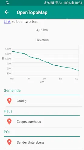
• Inspect track distance, elevation profiles, descriptions and waypoint details.
• Choose track colors and zoom to imported content.
• Enable KML/KMZ import to display additional map content.
MARKERS AND NEARBY PLACES
• Long-press the map to save a marker, then move, edit or delete it.
• Add names, descriptions, colors and optional labels.
• Import and export markers as GPX waypoints.
• Browse nearby Wikipedia places and show selected results on the map.
OPTIONAL ROUTE PLANNING AND PLACE SEARCH
Configure your own OpenRouteService (ORS) API key to search for places and calculate routes between markers. Choose profiles for driving, cycling, walking, hiking or wheelchair routing. Adjust waypoints on the map and inspect the resulting route and elevation data.
OFFLINE MAP TILES
Previously cached tiles can be viewed without an internet connection. You can also import a prepared OpenTopoMap tile ZIP into the cache and configure its location and size. Offline coverage depends on the tiles available on your device; uncached areas and zoom levels require an internet connection.
MAKE IT YOUR OWN
Keep the screen on while viewing the map and adjust map display settings. The interface is available in English, German, Spanish, French, Italian and Dutch.
Online map loading, Wikipedia lookups and ORS services require an internet connection. ORS routing, place search and optional elevation lookup require an API key and are subject to the service's usage limits.
OpenTopoMap Viewer is licensed under Apache 2.0. The F-Droid edition contains no ads.
MAPS AND LOCATION
• Choose from OpenTopoMap, OpenTopoMap-R, Top-O-Map, OpenStreetMap, OpenHikingMap and Freemap.sk.
• Add Waymarked Trails overlays for hiking and cycling routes.
• Follow your location, return to it quickly and rotate the map using the compass or GPS bearing.
• View coordinates and elevation information.
TRACKS AND WAYPOINTS
• Open GPX files to display tracks, routes and waypoints.
• Inspect track distance, elevation profiles, descriptions and waypoint details.
• Choose track colors and zoom to imported content.
• Enable KML/KMZ import to display additional map content.
MARKERS AND NEARBY PLACES
• Long-press the map to save a marker, then move, edit or delete it.
• Add names, descriptions, colors and optional labels.
• Import and export markers as GPX waypoints.
• Browse nearby Wikipedia places and show selected results on the map.
OPTIONAL ROUTE PLANNING AND PLACE SEARCH
Configure your own OpenRouteService (ORS) API key to search for places and calculate routes between markers. Choose profiles for driving, cycling, walking, hiking or wheelchair routing. Adjust waypoints on the map and inspect the resulting route and elevation data.
OFFLINE MAP TILES
Previously cached tiles can be viewed without an internet connection. You can also import a prepared OpenTopoMap tile ZIP into the cache and configure its location and size. Offline coverage depends on the tiles available on your device; uncached areas and zoom levels require an internet connection.
MAKE IT YOUR OWN
Keep the screen on while viewing the map and adjust map display settings. The interface is available in English, German, Spanish, French, Italian and Dutch.
Online map loading, Wikipedia lookups and ORS services require an internet connection. ORS routing, place search and optional elevation lookup require an API key and are subject to the service's usage limits.
OpenTopoMap Viewer is licensed under Apache 2.0. The F-Droid edition contains no ads.
All versions
| Version | Released | Minimum Android | Size |
|---|---|---|---|
| 1.42 | Nov 11, 2026 | Android 7.0 | 4.5 MB |
| 1.40 | Oct 22, 2026 | Android 7.0 | 4.5 MB |
| 1.39 | Oct 6, 2026 | Android 7.0 | 4.5 MB |
| 1.38 | Sep 14, 2026 | Android 7.0 | 4.5 MB |
| 1.37 | Sep 9, 2026 | Android 7.0 | 4.4 MB |
| 1.36 | Sep 3, 2026 | Android 7.0 | 4.4 MB |
| 1.35 | Sep 2, 2026 | Android 7.0 | 19 MB |
| 1.34 | Aug 26, 2026 | Android 7.0 | 19 MB |
| 1.33.4 | Aug 17, 2026 | Android 7.0 | 19 MB |
| 1.33.3 | Aug 3, 2026 | Android 7.0 | 18.8 MB |
| 1.33 | Jul 29, 2026 | Android 7.0 | 18.8 MB |
| 1.32.1 | Jul 28, 2026 | Android 7.0 | 18.8 MB |
| 1.30.1 | Jun 27, 2026 | Android 7.0 | 9 MB |
| 1.29.1 | Jun 3, 2026 | Android 7.0 | 9 MB |
| 1.29 | May 30, 2026 | Android 7.0 | 9 MB |
| 1.28.1 | May 7, 2026 | Android 7.0 | 8.5 MB |
| 1.28 | Apr 27, 2026 | Android 7.0 | 8.5 MB |
| 1.27 | Apr 20, 2026 | Android 7.0 | 8.5 MB |
| 1.26.2 | Jan 5, 2026 | Android 7.0 | 8.5 MB |
| 1.26.1 | Jan 3, 2026 | Android 7.0 | 8.5 MB |
| 1.26 | Jan 2, 2026 | Android 7.0 | 8.5 MB |
| 1.25 | Dec 8, 2025 | Android 7.0 | 8.5 MB |
| 1.24.2 | Nov 17, 2025 | Android 7.0 | 8.5 MB |
| 1.24.1 | Nov 13, 2025 | Android 7.0 | 8.4 MB |
| 1.24 | Oct 5, 2025 | Android 7.0 | 8.4 MB |
| 1.23.1 | Aug 17, 2025 | Android 7.0 | 8 MB |
| 1.22.2 | Jul 15, 2025 | Android 5.0 | 7.9 MB |
| 1.22 | Jun 22, 2025 | Android 5.0 | 7.4 MB |
| 1.21.1 | Jan 13, 2025 | Android 5.0 | 7.4 MB |
| 1.20 | Nov 12, 2024 | Android 5.0 | 7.3 MB |
| 1.18.1 | Jul 1, 2024 | Android 5.0 | 7.2 MB |
| 1.17 | Jun 12, 2024 | Android 5.0 | 7.3 MB |
| 1.16 | Apr 24, 2024 | Android 5.0 | 7.3 MB |
| 1.15.1 | Apr 22, 2024 | Android 5.0 | 7.3 MB |
| 1.15 | Apr 17, 2024 | Android 5.0 | 7.3 MB |
| 1.13.3 | Jul 12, 2023 | Android 5.0 | 6.8 MB |
| 1.13 | Jun 25, 2023 | Android 5.0 | 6.8 MB |
| 1.12.4 | Oct 23, 2022 | Android 5.0 | 4.7 MB |
| 1.12.3 | Oct 23, 2022 | Android 5.0 | 4.7 MB |
| 1.12.2 | Oct 9, 2022 | Android 5.0 | 4.7 MB |
| 1.11.9 | Oct 1, 2021 | Android 4.4 | 5.3 MB |
| 1.11.7 | Sep 2, 2021 | Android 4.4 | 5.3 MB |
| 1.11.6 | Jul 22, 2021 | Android 4.4 | 5.3 MB |
| 1.11.5 | Jan 3, 2021 | Android 4.4 | 4.9 MB |
| 1.11.2 | Sep 7, 2020 | Android 4.4 | 4.8 MB |
| 1.11.1 | Sep 3, 2020 | Android 4.4 | 4.7 MB |
| 1.11 | Jun 8, 2020 | Android 4.4 | 4.7 MB |
| 1.10.1 | Mar 16, 2020 | Android 4.4 | 4.7 MB |
| 1.10 | Mar 8, 2020 | Android 4.4 | 4.7 MB |
| 1.9.1 | Jan 29, 2020 | Android 4.4 | 4 MB |
| 1.9 | Jan 19, 2020 | Android 4.4 | 4 MB |
| 1.8 | Dec 26, 2019 | Android 4.4 | 4 MB |
| 1.7.1 | Dec 26, 2019 | Android 4.4 | 4 MB |
| 1.7 | Aug 3, 2019 | Android 4.4 | 4 MB |
| 1.6.1 | Jul 29, 2019 | Android 4.4 | 4 MB |
| 1.6 | Jul 29, 2019 | Android 4.4 | 4 MB |
| 1.5.1 | Mar 17, 2019 | Android 4.4 | 3.9 MB |
| 1.5 | Mar 13, 2019 | Android 4.4 | 3.9 MB |
| 1.4 | Jan 15, 2019 | Android 4.4 | 3.5 MB |
| 1.3.1 | Jan 8, 2019 | Android 4.4 | 3.5 MB |
| 1.3 | Jan 7, 2019 | Android 4.4 | 3.5 MB |
| 1.2.1 | Dec 27, 2018 | Android 4.4 | 3 MB |
| 1.2 | Dec 27, 2018 | Android 4.4 | 3 MB |
| 1.1 | Dec 12, 2018 | Android 4.4 | 3 MB |
| 1.0.4 | Nov 28, 2018 | Android 4.4 | 3 MB |
| 1.0.2 | Nov 19, 2018 | Android 4.4 | 2.4 MB |
How to install an older version of an Android app · How to install an APK file on Android
From the developer (GitHub)
APK files published by the developer on GitHub. They are signed by the developer and may not install over the other builds on this page (different signature). Links open github.com.
Similar apps
-
 RailTrip
Travel through the train stations to stamp your visa!
-
 Tower Collector
Join the community and collect cell towers locations from your area!
-
 OsmAnd~
Global Mobile Map Viewing & Navigation for Offline and Online OSM Maps
-
 Déjà Vu - A local RF based back end for the µg Pro
Mobile/cell and WLAN/Wi-Fi based network provider for UnifiedNlp and microG
-
 CoMaps - Hike, Bike, Drive Offline with Privacy
Easy map navigation - Discover more of your journey - Powered by the community
-
 Organic Maps・Offline Map & GPS
Get reliable offline maps with GPS navigation for hiking, cycling, and travel.
-
 BRouter
Get elevation-aware cycling directions
-
 Sky Map
 turns your phone into a window on the night sky.