

Navi
Offline-first navigation with terrain-aware eco routing
Depends on a specific server
- Developer
- Navi contributors
- License
- GPL-3.0-or-later
- Package
no.navi.app- Category
- Navigation
- Latest version
- 0.3.30-beta · Nov 4, 2026
- Minimum Android
- Android 8.0
Screenshots
Description
Navi is an offline-first navigation app. Download map data once, then plan and follow routes on the device without needing the internet for every trip.
Before first use: Navi does not come with a ready-made routing database, unlike many commercial navigation devices whose maker ships precomputed maps. Open the Tools menu and use Download region to get your region. Navi then downloads the map data and builds its routing and search databases on the device. This takes about 5 to 22 minutes per region depending on its size, for example about 5 minutes for a small country like Luxembourg and 20 to 22 minutes for a large region like Østlandet on a mid-range tablet. Route planning does not work until this is finished.
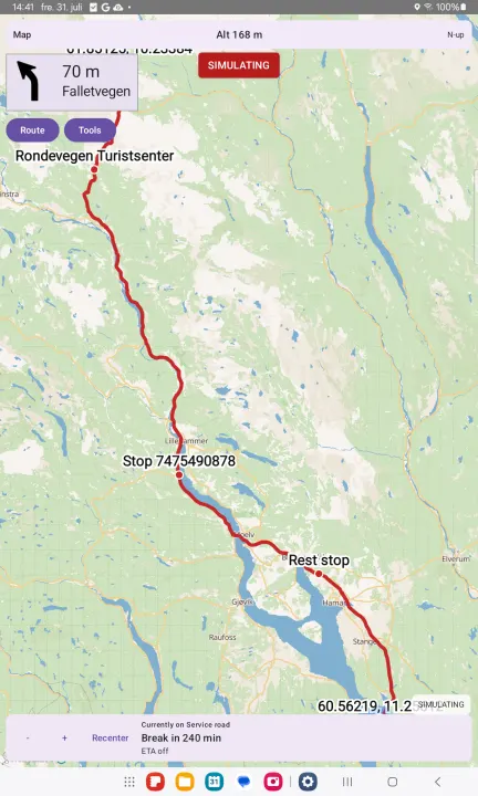
Travel modes include car, bicycle, e-bike, hiking, motorcycle, truck, and motorhome. Optional vehicle size limits skip roads that are too tight. Avoidances cover motorways and fast expressways, tolls, and ferries.
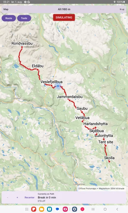
Eco routing prefers gentler, less energy-hungry roads by taking hills into account. Hiking and cycling can optionally prefer marked long-distance and pilgrim-style trails, with normal paths used when a marked trail has a gap.
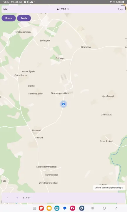
Download a region (OpenStreetMap extract), an offline basemap, and optional elevation/terrain data in Tools. A background indexing job builds compact routing packs so later plans are fast; you can still plan while indexing runs. Map updates are never silent — only when you ask.
On the road:
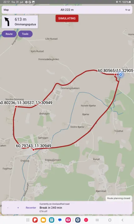
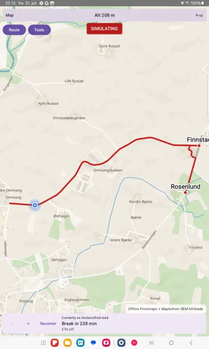
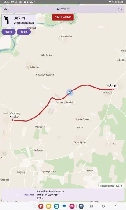
• Place search, From / Via / To, GPS fill, map mark and saved places
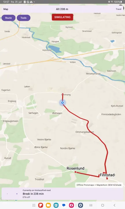
• Off-route detection and reroute
• Break and rest suggestions, including truck driving-time rules where known
• Drive bars with altitude and trip ETA
• GPS follow, and north-up / compass / direction-of-travel map rotation
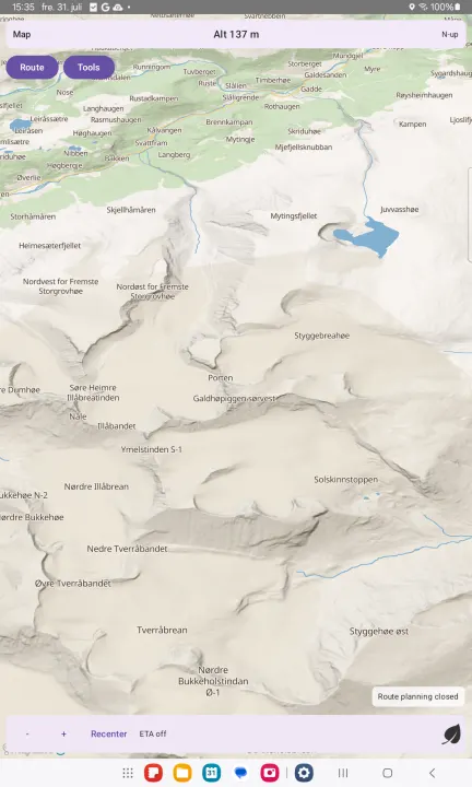
• Optional experimental 3D hill shading and map tilt
Navi is free and open source (GPL-3.0-or-later). There are no ads and no tracking. Network use is for downloads and updates you choose — not for silent data collection.
Before first use: Navi does not come with a ready-made routing database, unlike many commercial navigation devices whose maker ships precomputed maps. Open the Tools menu and use Download region to get your region. Navi then downloads the map data and builds its routing and search databases on the device. This takes about 5 to 22 minutes per region depending on its size, for example about 5 minutes for a small country like Luxembourg and 20 to 22 minutes for a large region like Østlandet on a mid-range tablet. Route planning does not work until this is finished.
Travel modes include car, bicycle, e-bike, hiking, motorcycle, truck, and motorhome. Optional vehicle size limits skip roads that are too tight. Avoidances cover motorways and fast expressways, tolls, and ferries.
Eco routing prefers gentler, less energy-hungry roads by taking hills into account. Hiking and cycling can optionally prefer marked long-distance and pilgrim-style trails, with normal paths used when a marked trail has a gap.
Download a region (OpenStreetMap extract), an offline basemap, and optional elevation/terrain data in Tools. A background indexing job builds compact routing packs so later plans are fast; you can still plan while indexing runs. Map updates are never silent — only when you ask.
On the road:
• Place search, From / Via / To, GPS fill, map mark and saved places
• Off-route detection and reroute
• Break and rest suggestions, including truck driving-time rules where known
• Drive bars with altitude and trip ETA
• GPS follow, and north-up / compass / direction-of-travel map rotation
• Optional experimental 3D hill shading and map tilt
Navi is free and open source (GPL-3.0-or-later). There are no ads and no tracking. Network use is for downloads and updates you choose — not for silent data collection.
All versions
| Version | Released | Minimum Android | Size |
|---|---|---|---|
| 0.3.30-beta | Nov 4, 2026 | Android 8.0 | 49.3 MB |
| 0.3.29-beta | Nov 1, 2026 | Android 8.0 | 49.2 MB |
| 0.3.26-beta | Oct 31, 2026 | Android 8.0 | 47.6 MB |
| 0.3.25-beta | Oct 16, 2026 | Android 8.0 | 46.4 MB |
How to install an older version of an Android app · How to install an APK file on Android
From the developer (GitHub)
APK files published by the developer on GitHub. They are signed by the developer and may not install over the other builds on this page (different signature). Links open github.com.
Similar apps
-
 RailTrip
Travel through the train stations to stamp your visa!
-
 Tower Collector
Join the community and collect cell towers locations from your area!
-
 OsmAnd~
Global Mobile Map Viewing & Navigation for Offline and Online OSM Maps
-
 Déjà Vu - A local RF based back end for the µg Pro
Mobile/cell and WLAN/Wi-Fi based network provider for UnifiedNlp and microG
-
 CoMaps - Hike, Bike, Drive Offline with Privacy
Easy map navigation - Discover more of your journey - Powered by the community
-
 Organic Maps・Offline Map & GPS
Get reliable offline maps with GPS navigation for hiking, cycling, and travel.
-
 BRouter
Get elevation-aware cycling directions
-
 Sky Map
 turns your phone into a window on the night sky.