

GPXIT
Find train connections home during your bike ride
Promotes non-free network services
- Developer
- 7FM
- License
- GPL-3.0-only
- Package
dev.gpxit.app- Category
- Navigation
- Latest version
- 0.3.0 · Sep 19, 2026
- Minimum Android
- Android 8.0
Screenshots
Description
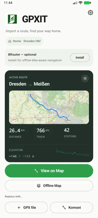
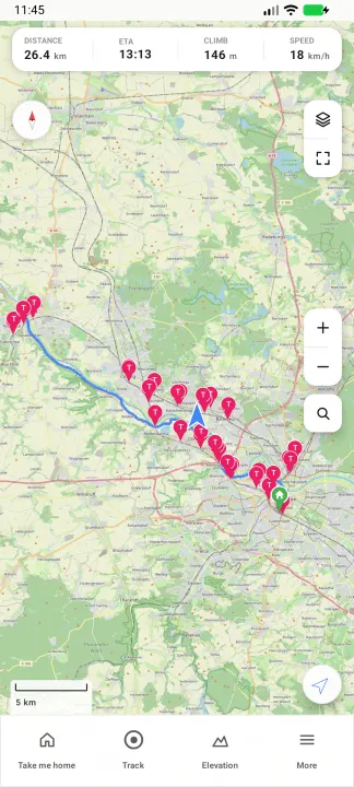
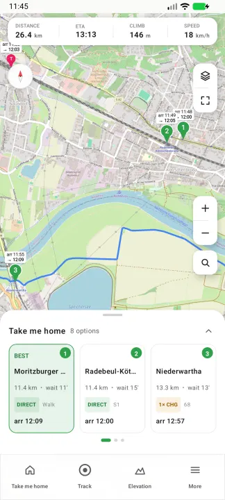
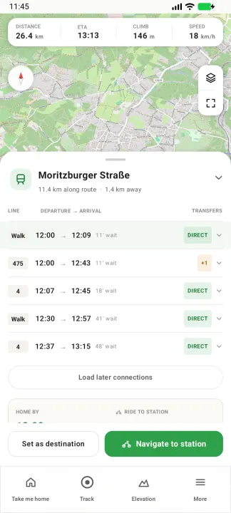
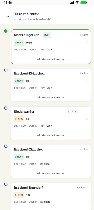
GPXIT helps cyclists who plan one-way bike routes and need to take a train home. Import your GPX route, and the app discovers train stations along your path. When you're ready to head home, it shows you the best options: which station to ride to, how long you'll wait, and when you'll arrive home.
Features:
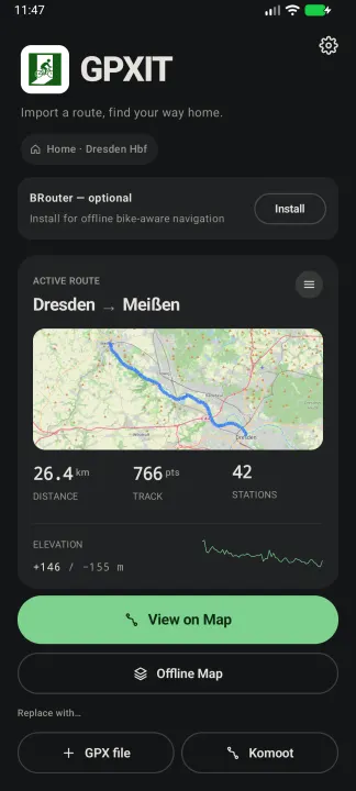
• Import GPX routes (share from Komoot or any cycling app)
• Automatic discovery of train stations along your route
• "Take me home" — see all upcoming stations with cycling time, wait time, and connections
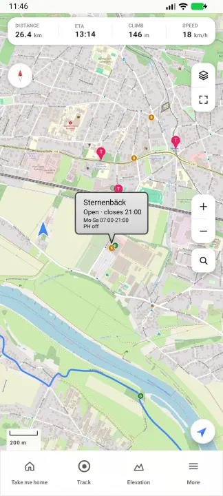
• Search for nearby stations anywhere on the map
• Detailed connection info with intermediate stops and changes
• Navigate to any station via your preferred map app
• Download map tiles for offline use
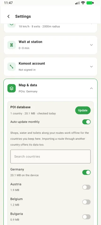
• Shops, bakeries, drinking water, toilets and bike repair along your route, with opening hours — offline, for the countries you choose
• Configurable transport types (regional trains, S-Bahn, U-Bahn, tram, bus, ferry)
• Optional ICE/IC/EC long-distance connections
• Transit data via Deutsche Bahn (covers German and international connections), plus Rejseplanen, Resrobot and Traveline where DB is weak, and optionally the community-run Transitous service
Privacy:
• No tracking, no analytics, no accounts
• All data stays on your device
• Location is only used to show your position on the map
• Internet is used only for map tiles (OpenStreetMap), transit queries (Deutsche Bahn; Rejseplanen, Resrobot or Traveline for places they cover; Transitous only if enabled) and downloading the offline POI data (GitHub)
Features:
• Import GPX routes (share from Komoot or any cycling app)
• Automatic discovery of train stations along your route
• "Take me home" — see all upcoming stations with cycling time, wait time, and connections
• Search for nearby stations anywhere on the map
• Detailed connection info with intermediate stops and changes
• Navigate to any station via your preferred map app
• Download map tiles for offline use
• Shops, bakeries, drinking water, toilets and bike repair along your route, with opening hours — offline, for the countries you choose
• Configurable transport types (regional trains, S-Bahn, U-Bahn, tram, bus, ferry)
• Optional ICE/IC/EC long-distance connections
• Transit data via Deutsche Bahn (covers German and international connections), plus Rejseplanen, Resrobot and Traveline where DB is weak, and optionally the community-run Transitous service
Privacy:
• No tracking, no analytics, no accounts
• All data stays on your device
• Location is only used to show your position on the map
• Internet is used only for map tiles (OpenStreetMap), transit queries (Deutsche Bahn; Rejseplanen, Resrobot or Traveline for places they cover; Transitous only if enabled) and downloading the offline POI data (GitHub)
All versions
| Version | Released | Minimum Android | Size |
|---|---|---|---|
| 0.3.0 | Sep 19, 2026 | Android 8.0 | 3 MB |
| 0.2.2 | Aug 17, 2026 | Android 8.0 | 2.9 MB |
| 0.2.1 | Jul 6, 2026 | Android 8.0 | 2.8 MB |
| 0.2.0 | Jul 2, 2026 | Android 8.0 | 2.8 MB |
How to install an older version of an Android app · How to install an APK file on Android
From the developer (GitHub)
APK files published by the developer on GitHub. They are signed by the developer and may not install over the other builds on this page (different signature). Links open github.com.
Similar apps
-
 RailTrip
Travel through the train stations to stamp your visa!
-
 Tower Collector
Join the community and collect cell towers locations from your area!
-
 OsmAnd~
Global Mobile Map Viewing & Navigation for Offline and Online OSM Maps
-
 Déjà Vu - A local RF based back end for the µg Pro
Mobile/cell and WLAN/Wi-Fi based network provider for UnifiedNlp and microG
-
 CoMaps - Hike, Bike, Drive Offline with Privacy
Easy map navigation - Discover more of your journey - Powered by the community
-
 Organic Maps・Offline Map & GPS
Get reliable offline maps with GPS navigation for hiking, cycling, and travel.
-
 BRouter
Get elevation-aware cycling directions
-
 Sky Map
 turns your phone into a window on the night sky.