

Alpi Maps
owerful outdoor maps & navigation — everything works 100% offline or online
- Developer
- Akylas
- License
- MIT
- Package
akylas.alpi.maps- Category
- Navigation
- Latest version
- 3.0.8.284 · Jun 3, 2026
- Minimum Android
- Android 5.0
Screenshots
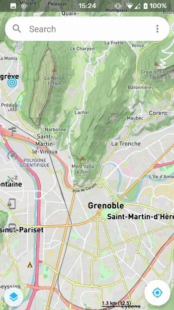
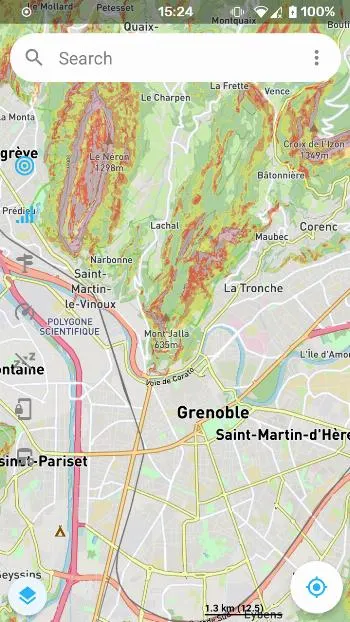
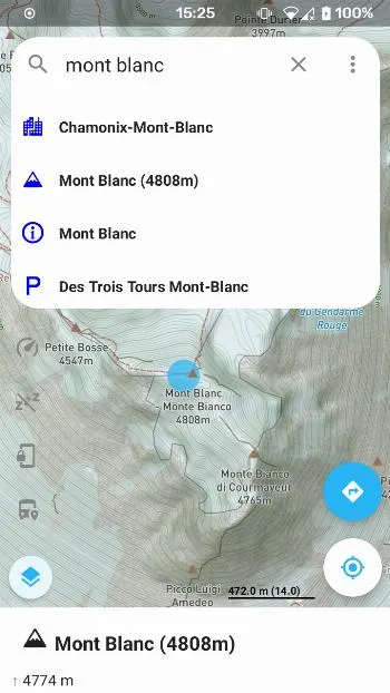
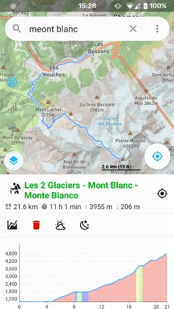
Description
AlpiMaps is the map app for real outdoor adventures — built for hikers, cyclists, travelers and explorers who need reliable maps, navigation and terrain tools whether they’re online or deep in the backcountry.
Everything works online or offline Download map packs to your device or stream maps when you have a connection — AlpiMaps keeps the same powerful features available either way: maps, search, routing, elevation, statistics, 3D terrain and more.
Top features
• Truly offline navigation: turn-by-turn directions for walking, cycling and driving — online or offline.
• Route planning & road stats: build routes, save routes and get detailed stats (distance, ascent/descent, surfaces and grades) so you can plan rides and hikes with confidence.
• Advanced elevation & 3D terrain: elevation profiles, hillshade and terrarium/3D terrain views so you can see the landscape before you go.
• Offline search & place lookup: find towns, trails and POIs even with no mobile signal.
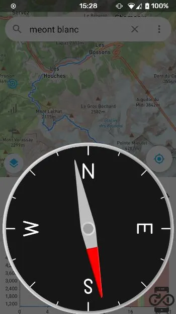
• Peak finder & compass: identify nearby peaks, get bearings and distances, and use a compass that can aim at selected locations.
• GPS satellites view: check satellite signal and status for better GPS troubleshooting and performance.
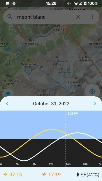
• Astronomy tools: sun & moon info, local time at any location, daylight times and other handy astronomy data for planning trips.
• Map interaction & customization: inspect points/lines/polygons, toggle map rotation and pitch, enable/disable layers and choose map styles.
• Work with map packs or create your own: offline maps work with generated custom map data with the AlpiMaps data generator (see on Github) — then add them to the app to unlock richer offline features.
• Privacy-first & battery-friendly: use offline data to keep everything local, and tune GPS frequency/accuracy to save battery on long trips.
Who it’s for
• Hikers and backcountry cyclists who need dependable offline maps and elevation tools.
• Travelers who want offline navigation and searchable maps anywhere.
• Outdoor planners and power users who want to create and customize map packs.
Get started Install AlpiMaps, choose an online provider to stream maps or add a downloaded map pack to enable full offline mode. For power users and tinkerers: learn how to create custom map packs with the AlpiMaps data generator (link in app documentation).
Download AlpiMaps and go explore — online when you want it, offline when it matters.
Everything works online or offline Download map packs to your device or stream maps when you have a connection — AlpiMaps keeps the same powerful features available either way: maps, search, routing, elevation, statistics, 3D terrain and more.
Top features
• Truly offline navigation: turn-by-turn directions for walking, cycling and driving — online or offline.
• Route planning & road stats: build routes, save routes and get detailed stats (distance, ascent/descent, surfaces and grades) so you can plan rides and hikes with confidence.
• Advanced elevation & 3D terrain: elevation profiles, hillshade and terrarium/3D terrain views so you can see the landscape before you go.
• Offline search & place lookup: find towns, trails and POIs even with no mobile signal.
• Peak finder & compass: identify nearby peaks, get bearings and distances, and use a compass that can aim at selected locations.
• GPS satellites view: check satellite signal and status for better GPS troubleshooting and performance.
• Astronomy tools: sun & moon info, local time at any location, daylight times and other handy astronomy data for planning trips.
• Map interaction & customization: inspect points/lines/polygons, toggle map rotation and pitch, enable/disable layers and choose map styles.
• Work with map packs or create your own: offline maps work with generated custom map data with the AlpiMaps data generator (see on Github) — then add them to the app to unlock richer offline features.
• Privacy-first & battery-friendly: use offline data to keep everything local, and tune GPS frequency/accuracy to save battery on long trips.
Who it’s for
• Hikers and backcountry cyclists who need dependable offline maps and elevation tools.
• Travelers who want offline navigation and searchable maps anywhere.
• Outdoor planners and power users who want to create and customize map packs.
Get started Install AlpiMaps, choose an online provider to stream maps or add a downloaded map pack to enable full offline mode. For power users and tinkerers: learn how to create custom map packs with the AlpiMaps data generator (link in app documentation).
Download AlpiMaps and go explore — online when you want it, offline when it matters.
All versions
| Version | Released | Minimum Android | Size |
|---|---|---|---|
| 3.0.8.284 | Jun 3, 2026 | Android 5.0 | 21.3 MB |
| 3.0.6.282 | Mar 20, 2026 | Android 5.0 | 21.3 MB |
How to install an older version of an Android app · How to install an APK file on Android
From the developer (GitHub)
APK files published by the developer on GitHub. They are signed by the developer and may not install over the other builds on this page (different signature). Links open github.com.
android/github/3.0.8/284
· Jun 3, 2026
app-arm64-v8a-release.apk
21.3 MB app-armeabi-v7a-release.apk
19.5 MB android/github/3.0.7/283
· Jun 3, 2026
app-arm64-v8a-release.apk
21.3 MB app-armeabi-v7a-release.apk
19.5 MB android/github/3.0.6/282
· Mar 20, 2026
app-arm64-v8a-release.apk
21.3 MB app-armeabi-v7a-release.apk
19.6 MB Similar apps
-
 RailTrip
Travel through the train stations to stamp your visa!
-
 Tower Collector
Join the community and collect cell towers locations from your area!
-
 OsmAnd~
Global Mobile Map Viewing & Navigation for Offline and Online OSM Maps
-
 Déjà Vu - A local RF based back end for the µg Pro
Mobile/cell and WLAN/Wi-Fi based network provider for UnifiedNlp and microG
-
 CoMaps - Hike, Bike, Drive Offline with Privacy
Easy map navigation - Discover more of your journey - Powered by the community
-
 Organic Maps・Offline Map & GPS
Get reliable offline maps with GPS navigation for hiking, cycling, and travel.
-
 BRouter
Get elevation-aware cycling directions
-
 Sky Map
 turns your phone into a window on the night sky.