

Datum
Offline topo, satellite and public land maps. No account, no ads, no tracking.
Promotes non-free network services
- Developer
- 0x44616D69616E
- License
- MIT
- Package
org.freemaps.datum- Category
- Navigation, Sports & Health
- Latest version
- 1.6.11 · Oct 27, 2026
- Minimum Android
- Android 5.1
Screenshots
Description
A fully offline topographic, satellite and trail map for Android, built for the moment you lose signal and still need to know where you are.
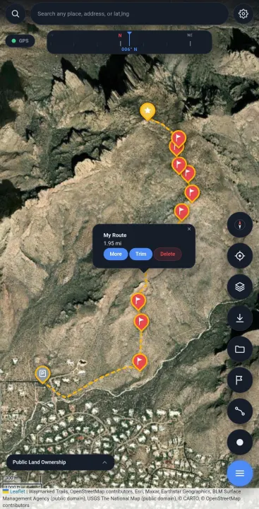
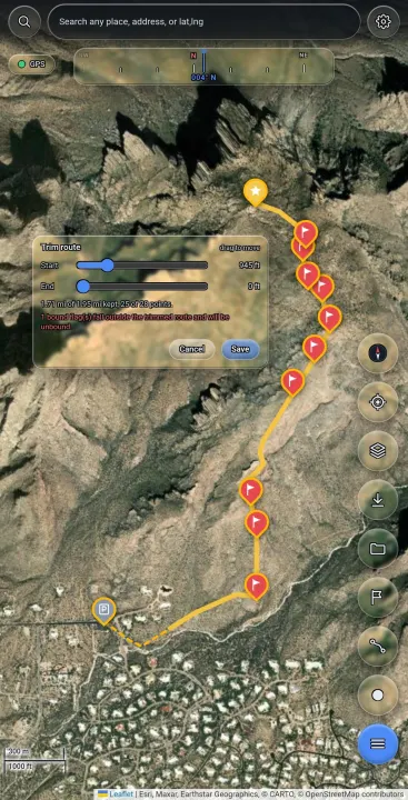
Download a region before you leave and everything keeps working with no connection: the map, GPS position, waypoints, route planning and track recording. Satellite imagery, USGS topographic contours, trails, public land ownership, borders and street labels are all cached on the device rather than fetched on demand.
Features:
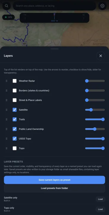
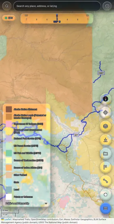
• Seven map layers that can be reordered, hidden, and given independent transparency, so contours can be read through imagery
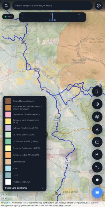
• Public land ownership from the BLM Surface Management Agency dataset, showing BLM, Forest Service, state, tribal and private land
• USGS topographic contours labelled in feet, plus OpenTopoMap in metres
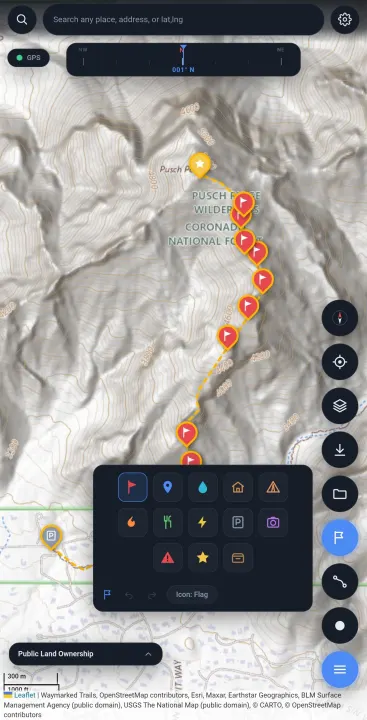
• Waypoints with thirteen icon types, undo and redo
• Route planning, either point by point or by connecting waypoints, with trimming and turn by turn navigation
• Track recording with live distance and elapsed time
• Sessions, so each trip's waypoints, routes and tracks stay separate
• Layer presets that can be saved and shared, containing settings only and no locations
Your data is written to a folder you choose as standard GPX files as you create them, so it opens in other outdoor applications with no export step, and nothing is locked in a proprietary format. Timestamps are left out of shared files by default, because a path shows where a trail goes while timestamps also show what hours you were out.
There is no account, no advertising, no analytics and no server.
Note on the anti-feature flag: the satellite imagery layer is served by Esri, a proprietary service. Every other layer comes from public domain government or openly licensed sources. Place search uses Nominatim. All network access is initiated by the user; nothing is contacted in the background.
Download a region before you leave and everything keeps working with no connection: the map, GPS position, waypoints, route planning and track recording. Satellite imagery, USGS topographic contours, trails, public land ownership, borders and street labels are all cached on the device rather than fetched on demand.
Features:
• Seven map layers that can be reordered, hidden, and given independent transparency, so contours can be read through imagery
• Public land ownership from the BLM Surface Management Agency dataset, showing BLM, Forest Service, state, tribal and private land
• USGS topographic contours labelled in feet, plus OpenTopoMap in metres
• Waypoints with thirteen icon types, undo and redo
• Route planning, either point by point or by connecting waypoints, with trimming and turn by turn navigation
• Track recording with live distance and elapsed time
• Sessions, so each trip's waypoints, routes and tracks stay separate
• Layer presets that can be saved and shared, containing settings only and no locations
Your data is written to a folder you choose as standard GPX files as you create them, so it opens in other outdoor applications with no export step, and nothing is locked in a proprietary format. Timestamps are left out of shared files by default, because a path shows where a trail goes while timestamps also show what hours you were out.
There is no account, no advertising, no analytics and no server.
Note on the anti-feature flag: the satellite imagery layer is served by Esri, a proprietary service. Every other layer comes from public domain government or openly licensed sources. Place search uses Nominatim. All network access is initiated by the user; nothing is contacted in the background.
All versions
| Version | Released | Minimum Android | Size |
|---|---|---|---|
| 1.6.11 | Oct 27, 2026 | Android 5.1 | 2.9 MB |
How to install an older version of an Android app · How to install an APK file on Android
From the developer (GitHub)
APK files published by the developer on GitHub. They are signed by the developer and may not install over the other builds on this page (different signature). Links open github.com.
Similar apps
-
 openScale
Weight and body metrics tracker, with support for Bluetooth scales
-
 Food You - Calorie Tracker & Food Diary
Track your calories with Material You aesthetic
-
 OpenTracks (Non-reproducible)
A sport tracker buddy that respects your privacy.
-
 OpenTracks (Reproducible build)
A sport tracker buddy that respects your privacy.
-
 RailTrip
Travel through the train stations to stamp your visa!
-
 Tower Collector
Join the community and collect cell towers locations from your area!
-
 OsmAnd~
Global Mobile Map Viewing & Navigation for Offline and Online OSM Maps
-
 OpenBeautyFacts
Look up cosmetic