
Bivouac
Plan multi-day hikes, relive and analyse the ones already done
Promotes non-free network services
- License
- GPL-3.0-only
- Package
com.bivouac.app- Category
- Navigation, Sports & Health
- Latest version
- 2.7.2 · Nov 11, 2026
- Minimum Android
- Android 8.0
Screenshots
Description
Bivouac splits a GPX track into stages around bivouac spots, then keeps every outing in a journal, with its photos and its figures. It is for before and after the outing: planning multi-day hikes, then reliving and analysing the ones already done.
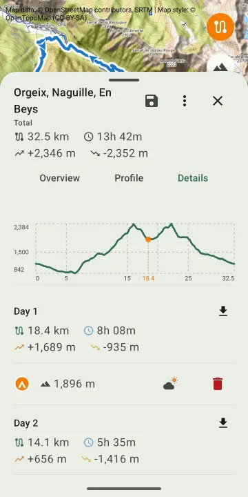
Plan: import a GPX track of one or several days, place the bivouacs on the route. Distance, elevation and estimated duration are recalculated for each stage. Altitude and a weather link for each bivouac, export of a stage as GPX, a bank of prepared tracks.
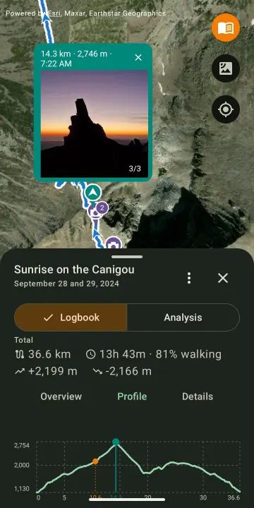
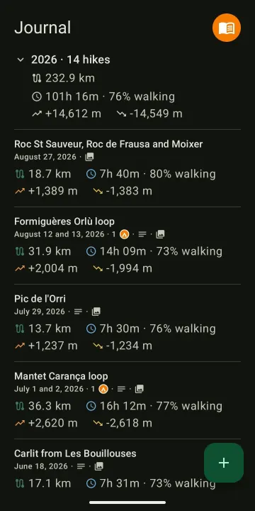
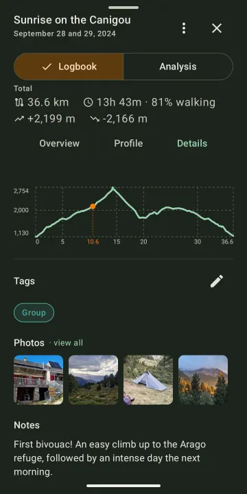
Remember: keep every completed hike with a note, tags, and photos placed on the track where they were taken. The selection screen offers the photos taken during the hike first, with access to the whole gallery. Each photo can be cropped, captioned or moved along the track, and opens full screen.
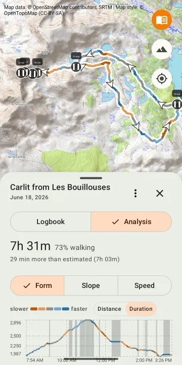
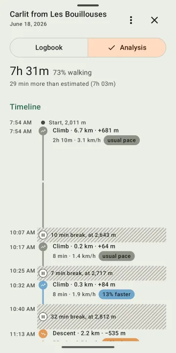
Analyse: see your form on the day, the slope or the speed along the track, read each section, compare with the usual pace and with the estimate, separate walking time from breaks. A timeline of the outing shows climbs, descents and breaks, nights at the bivouac included.
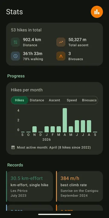
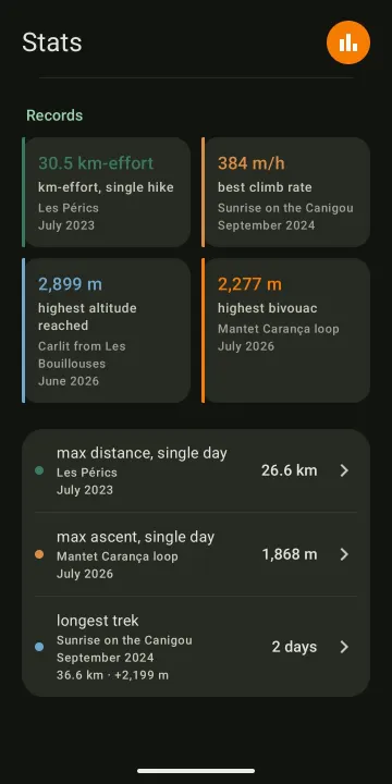
Measure: totals, month-by-month progress and personal records, with actual duration and walking share. Each record leads back to the hike it comes from.
No account, no tracking, no collection:
• Everything on the device: tracks, journal and photos are stored on the device, with nothing sent to a server run by the developer.
• No account, no ads, no tracking: no usage statistics, no tracker, no crash reports.
• No location tracking: the app never accesses the device's location.
• Free software under the GPL-3.0 licence: the source code is public.
The app's only network connection: downloading map tiles. The satellite layer (Esri) and the weather link (Meteoblue), which are non-free services, are turned off by a single switch in Settings.
Photos: to place a photo on the track, Bivouac reads the GPS position stored in the photo. This needs read access to images and the "media location" permission, both requested only on first use of photos. The feature can be turned off in Settings, and photos never leave the device.
What Bivouac does not do: no guidance, no track recording, no social network. Tracks come from the watch, the GPS or the app used during the outing, in GPX format.
Interface in English and French, following the device's language. Android 8 and later.
Website: https://bivouac.rseb.net
Plan: import a GPX track of one or several days, place the bivouacs on the route. Distance, elevation and estimated duration are recalculated for each stage. Altitude and a weather link for each bivouac, export of a stage as GPX, a bank of prepared tracks.
Remember: keep every completed hike with a note, tags, and photos placed on the track where they were taken. The selection screen offers the photos taken during the hike first, with access to the whole gallery. Each photo can be cropped, captioned or moved along the track, and opens full screen.
Analyse: see your form on the day, the slope or the speed along the track, read each section, compare with the usual pace and with the estimate, separate walking time from breaks. A timeline of the outing shows climbs, descents and breaks, nights at the bivouac included.
Measure: totals, month-by-month progress and personal records, with actual duration and walking share. Each record leads back to the hike it comes from.
No account, no tracking, no collection:
• Everything on the device: tracks, journal and photos are stored on the device, with nothing sent to a server run by the developer.
• No account, no ads, no tracking: no usage statistics, no tracker, no crash reports.
• No location tracking: the app never accesses the device's location.
• Free software under the GPL-3.0 licence: the source code is public.
The app's only network connection: downloading map tiles. The satellite layer (Esri) and the weather link (Meteoblue), which are non-free services, are turned off by a single switch in Settings.
Photos: to place a photo on the track, Bivouac reads the GPS position stored in the photo. This needs read access to images and the "media location" permission, both requested only on first use of photos. The feature can be turned off in Settings, and photos never leave the device.
What Bivouac does not do: no guidance, no track recording, no social network. Tracks come from the watch, the GPS or the app used during the outing, in GPX format.
Interface in English and French, following the device's language. Android 8 and later.
Website: https://bivouac.rseb.net
All versions
| Version | Released | Minimum Android | Size |
|---|---|---|---|
| 2.7.2 | Nov 11, 2026 | Android 8.0 | 3.7 MB |
| 2.7.1 | Oct 27, 2026 | Android 8.0 | 15.8 MB |
| 2.7.0 | Oct 25, 2026 | Android 8.0 | 15.7 MB |
How to install an older version of an Android app · How to install an APK file on Android
From the developer (GitHub)
APK files published by the developer on GitHub. They are signed by the developer and may not install over the other builds on this page (different signature). Links open github.com.
Similar apps
-
 openScale
Weight and body metrics tracker, with support for Bluetooth scales
-
 Food You - Calorie Tracker & Food Diary
Track your calories with Material You aesthetic
-
 OpenTracks (Non-reproducible)
A sport tracker buddy that respects your privacy.
-
 OpenTracks (Reproducible build)
A sport tracker buddy that respects your privacy.
-
 RailTrip
Travel through the train stations to stamp your visa!
-
 Tower Collector
Join the community and collect cell towers locations from your area!
-
 OsmAnd~
Global Mobile Map Viewing & Navigation for Offline and Online OSM Maps
-
 OpenBeautyFacts
Look up cosmetic