

LocalCrop
Find local farms and farmers markets near you using public USDA data.
Depends on a specific server
- Developer
- Cole McDaniel
- License
- AGPL-3.0-only
- Package
xyz.cmcdaniel.localcrop- Category
- Navigation
- Latest version
- 1.1.0 · Jul 14, 2026
- Minimum Android
- Android 7.0
Screenshots
Description
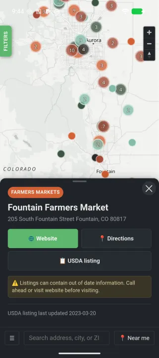
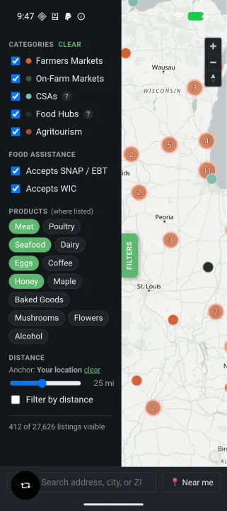
LocalCrop puts ~28,000 farms, farmers markets, CSAs, food hubs, and agritourism listings on an interactive map. All data comes from the USDA Local Food Directories, which is public domain.
Search by location, filter by type, and find what's near you. Tap a listing to see contact info, website, address, and a link to the vendor's USDA directory page.
Features:
• Interactive map with ~28,000 listings across the United States
• Filter by type: farmers markets, on-farm markets, CSAs, food hubs, agritourism
• Search by address or use your device's location
• Tap listings for contact details, websites, and directions
• Works offline with bundled data — no account or internet required after install
• No tracking, no ads, no data collection
Data is voluntarily reported to the USDA by market managers, farm representatives, and state agriculture agencies. LocalCrop links to vendor websites and phone numbers so you can verify details before visiting.
Built with MapLibre GL JS and OpenFreeMap tiles. Entirely open source under the AGPL-3.0 license.
Search by location, filter by type, and find what's near you. Tap a listing to see contact info, website, address, and a link to the vendor's USDA directory page.
Features:
• Interactive map with ~28,000 listings across the United States
• Filter by type: farmers markets, on-farm markets, CSAs, food hubs, agritourism
• Search by address or use your device's location
• Tap listings for contact details, websites, and directions
• Works offline with bundled data — no account or internet required after install
• No tracking, no ads, no data collection
Data is voluntarily reported to the USDA by market managers, farm representatives, and state agriculture agencies. LocalCrop links to vendor websites and phone numbers so you can verify details before visiting.
Built with MapLibre GL JS and OpenFreeMap tiles. Entirely open source under the AGPL-3.0 license.
All versions
| Version | Released | Minimum Android | Size |
|---|---|---|---|
| 1.1.0 | Jul 14, 2026 | Android 7.0 | 6.4 MB |
| 1.0.1 | Jun 9, 2026 | Android 7.0 | 6.4 MB |
| 1.0.0 | May 24, 2026 | Android 7.0 | 6.4 MB |
How to install an older version of an Android app · How to install an APK file on Android
Similar apps
-
 RailTrip
Travel through the train stations to stamp your visa!
-
 Tower Collector
Join the community and collect cell towers locations from your area!
-
 OsmAnd~
Global Mobile Map Viewing & Navigation for Offline and Online OSM Maps
-
 Déjà Vu - A local RF based back end for the µg Pro
Mobile/cell and WLAN/Wi-Fi based network provider for UnifiedNlp and microG
-
 CoMaps - Hike, Bike, Drive Offline with Privacy
Easy map navigation - Discover more of your journey - Powered by the community
-
 Organic Maps・Offline Map & GPS
Get reliable offline maps with GPS navigation for hiking, cycling, and travel.
-
 BRouter
Get elevation-aware cycling directions
-
 Sky Map
 turns your phone into a window on the night sky.