

CamEscape
Map surveillance cameras from OpenStreetMap and plan routes that avoid them
- Developer
- 137View
- License
- GPL-3.0-only
- Package
com.one37view.camescape- Category
- Navigation
- Latest version
- 1.3.3 · Oct 25, 2026
- Minimum Android
- Android 7.0
Screenshots
Description
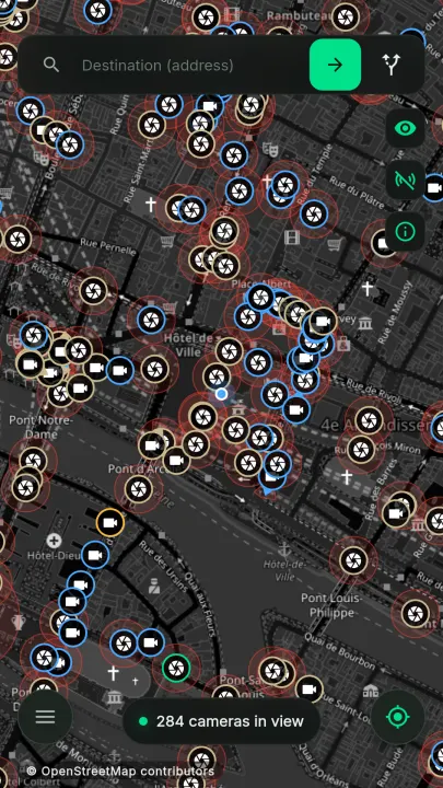
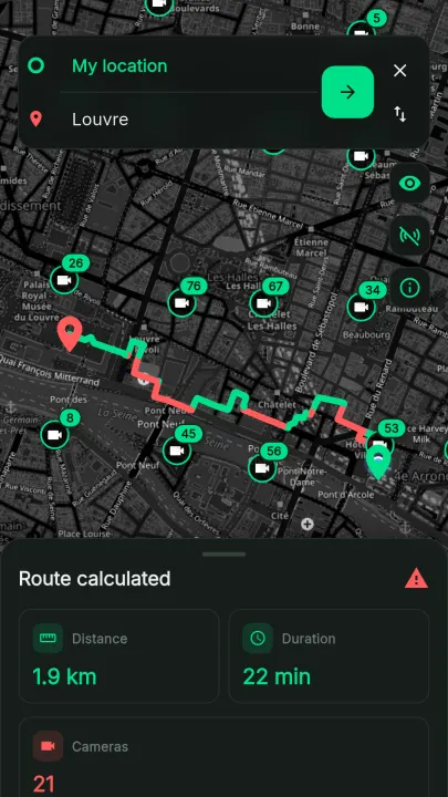
CamEscape maps surveillance cameras recorded in OpenStreetMap and plans walking, cycling or driving routes that avoid them.
Features
• Camera-aware routing: routes that steer clear of cameras, with clear (green) and watched (red) segments
• Adjustable avoidance strength
• Field of view: cones for fixed cameras when their direction is mapped, coverage zones for dome cameras
• Walking, cycling and driving modes
• Live mode that follows your position and warns when a camera on the route cannot be avoided or the route hits a dead end
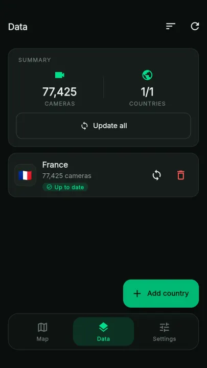
• Cameras downloaded per country in a few seconds and stored on the device (SQLite), viewable offline; map tiles you have already seen are cached
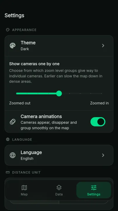
• Light/dark theme, English and French, metric/imperial units
Privacy
No account, no analytics, no ads, no identifier sent. A country's cameras are downloaded from a file hosted on GitLab Pages, which receives your IP address and the requested country. Your position is sent without any identifier to OpenStreetMap's Nominatim to suggest your country, and, in live mode, an area around you is sent to a public Overpass instance to fetch nearby roads. Route bounding boxes also go to Overpass. Overpass instances are run by independent operators and receive your IP address.
Route planning and live mode require a connection. Camera data is community-mapped and may be incomplete: CamEscape is a planning aid, not a guarantee of being unobserved. Missing cameras can be added to OpenStreetMap (man_made=surveillance).
Features
• Camera-aware routing: routes that steer clear of cameras, with clear (green) and watched (red) segments
• Adjustable avoidance strength
• Field of view: cones for fixed cameras when their direction is mapped, coverage zones for dome cameras
• Walking, cycling and driving modes
• Live mode that follows your position and warns when a camera on the route cannot be avoided or the route hits a dead end
• Cameras downloaded per country in a few seconds and stored on the device (SQLite), viewable offline; map tiles you have already seen are cached
• Light/dark theme, English and French, metric/imperial units
Privacy
No account, no analytics, no ads, no identifier sent. A country's cameras are downloaded from a file hosted on GitLab Pages, which receives your IP address and the requested country. Your position is sent without any identifier to OpenStreetMap's Nominatim to suggest your country, and, in live mode, an area around you is sent to a public Overpass instance to fetch nearby roads. Route bounding boxes also go to Overpass. Overpass instances are run by independent operators and receive your IP address.
Route planning and live mode require a connection. Camera data is community-mapped and may be incomplete: CamEscape is a planning aid, not a guarantee of being unobserved. Missing cameras can be added to OpenStreetMap (man_made=surveillance).
All versions
| Version | Released | Minimum Android | Size |
|---|---|---|---|
| 1.3.3 (3 builds) | Oct 25, 2026 | Android 7.0 | 25.1 MB |
| 1.3.1 (3 builds) | Oct 16, 2026 | Android 7.0 | 25 MB |
How to install an older version of an Android app · How to install an APK file on Android
Similar apps
-
 RailTrip
Travel through the train stations to stamp your visa!
-
 Tower Collector
Join the community and collect cell towers locations from your area!
-
 OsmAnd~
Global Mobile Map Viewing & Navigation for Offline and Online OSM Maps
-
 Déjà Vu - A local RF based back end for the µg Pro
Mobile/cell and WLAN/Wi-Fi based network provider for UnifiedNlp and microG
-
 CoMaps - Hike, Bike, Drive Offline with Privacy
Easy map navigation - Discover more of your journey - Powered by the community
-
 Organic Maps・Offline Map & GPS
Get reliable offline maps with GPS navigation for hiking, cycling, and travel.
-
 BRouter
Get elevation-aware cycling directions
-
 Sky Map
 turns your phone into a window on the night sky.