

Megalith LiDAR
UK 1 m LiDAR & aerial cropmark monument atlas with OsmAnd GPS exports
Promotes non-free network services Depends on a specific server
- Developer
- GlassOnTin
- License
- AGPL-3.0-only
- Package
uk.megalith.lidar- Category
- Navigation, Science & Education
- Latest version
- 3.2.0 · Nov 17, 2026
- Minimum Android
- Android 8.0
Screenshots
Description
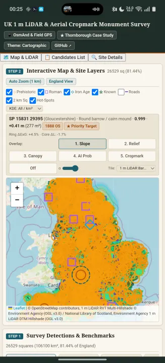
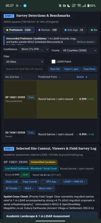
Megalith LiDAR is an open-source field survey atlas of unrecorded Prehistoric, Iron Age, and Roman earthwork candidates across England, detected from 1 m Environment Agency bare-earth LiDAR and 16 m aerial cropmarks.
Every candidate is cross-checked against 1888–1913 Ordnance Survey Six-Inch maps, Historic England's National Heritage List for England (NHLE), OpenStreetMap archaeology and modern confounders, and Megalithic.co.uk.
Key Features:
• Offline Bundled Survey Dataset: Browse Prehistoric barrows, henges, Roman villas/camps/aggers, Iron Age hillforts, settlement enclosures, and rediscovered Scheduled Monuments across English counties with no account or tracking.
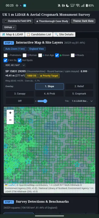
• Interactive Multi-Layer Map & 7-Panel Site Inspector: Switch between 1 m LiDAR DTM Bare-Earth Hillshade, 1 m LiDAR RVT Multi-Hillshade, 1 m LiDAR DSM Canopy, 1888–1913 OS Six-Inch maps, Roman Empire Atlas (DARE), BGS 1:50k Bedrock Geology, and aerial imagery, with geo-draped 256 m × 256 m slope, 16 m local relief, canopy, AI probability, and aerial cropmark overlays.
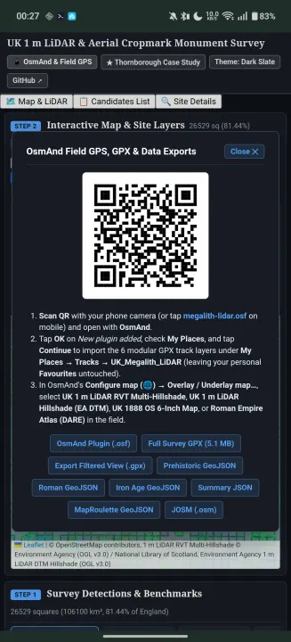
• One-Tap OsmAnd & Field GPS Integration: Export the custom OsmAnd plugin (.osf) with modular GPX track layers, Roman and ancient ridgeway routes, and custom 1 m LiDAR / 1888 OS map sources, or export filtered GPX waypoints directly to OsmAnd, Organic Maps, Garmin, or QGIS.
• Near Me GPS & Field Survey Log: Sort candidates by distance from your live GPS position and record ground-truthing verdicts, Historic Environment Record (HER) references, and field observations locally with JSON import/export.
Licensed under GNU AGPL v3.0. Contains Environment Agency Open LiDAR data (OGL v3.0), Historic England NHLE data (OGL v3.0), and OpenStreetMap contributors (ODbL).
Every candidate is cross-checked against 1888–1913 Ordnance Survey Six-Inch maps, Historic England's National Heritage List for England (NHLE), OpenStreetMap archaeology and modern confounders, and Megalithic.co.uk.
Key Features:
• Offline Bundled Survey Dataset: Browse Prehistoric barrows, henges, Roman villas/camps/aggers, Iron Age hillforts, settlement enclosures, and rediscovered Scheduled Monuments across English counties with no account or tracking.
• Interactive Multi-Layer Map & 7-Panel Site Inspector: Switch between 1 m LiDAR DTM Bare-Earth Hillshade, 1 m LiDAR RVT Multi-Hillshade, 1 m LiDAR DSM Canopy, 1888–1913 OS Six-Inch maps, Roman Empire Atlas (DARE), BGS 1:50k Bedrock Geology, and aerial imagery, with geo-draped 256 m × 256 m slope, 16 m local relief, canopy, AI probability, and aerial cropmark overlays.
• One-Tap OsmAnd & Field GPS Integration: Export the custom OsmAnd plugin (.osf) with modular GPX track layers, Roman and ancient ridgeway routes, and custom 1 m LiDAR / 1888 OS map sources, or export filtered GPX waypoints directly to OsmAnd, Organic Maps, Garmin, or QGIS.
• Near Me GPS & Field Survey Log: Sort candidates by distance from your live GPS position and record ground-truthing verdicts, Historic Environment Record (HER) references, and field observations locally with JSON import/export.
Licensed under GNU AGPL v3.0. Contains Environment Agency Open LiDAR data (OGL v3.0), Historic England NHLE data (OGL v3.0), and OpenStreetMap contributors (ODbL).
All versions
| Version | Released | Minimum Android | Size |
|---|---|---|---|
| 3.2.0 | Nov 17, 2026 | Android 8.0 | 13.3 MB |
How to install an older version of an Android app · How to install an APK file on Android
From the developer (GitHub)
APK files published by the developer on GitHub. They are signed by the developer and may not install over the other builds on this page (different signature). Links open github.com.
Similar apps
-
 Converter NOW: Unit Converter
A simple, immediate and fast unit converter!
-
 Braincup - Brain Training
Train your focus, memory and math skills.
-
 RailTrip
Travel through the train stations to stamp your visa!
-
 Tower Collector
Join the community and collect cell towers locations from your area!
-
 OsmAnd~
Global Mobile Map Viewing & Navigation for Offline and Online OSM Maps
-
 microMathematics Plus
Computer algebra system
-
 Déjà Vu - A local RF based back end for the µg Pro
Mobile/cell and WLAN/Wi-Fi based network provider for UnifiedNlp and microG
-
 CoMaps - Hike, Bike, Drive Offline with Privacy
Easy map navigation - Discover more of your journey - Powered by the community